Tuesday, November 6, 2012

The Garden by the Fort


This post will begin to describe the results of our 2012 archaeological testing at the site of the 1732 Fort de Chartres, in Randolph County, Illinois. The fort was built by the French to provide a military and governmental center for the Illinois Country colony. It was the third of four versions of the fortification.
Like most French colonial forts of the period, this version of Fort de Chartres was of the “Vauban” plan, consisting of central square area flanked by four diamond-shaped bastions. The central area housed most of the buildings associated with the fort (as well as the parade grounds), while the bastions provided defensive views of the walls of the fort and also housed specialized buildings. The walls of the fort were constructed of wooden poles set into deep trenches. The outlines of those trenches are still visible in the subsoil today, and allow us to accurately map the size and shape of the structure.

Our work at the site exposed the northeast bastion of the fort.  The base map above shows the features that we encountered there. The tan color represents areas of subsoil exposed by our test units and trenches. The black lines represent wall trench features. The gray shapes are pit features, and the small red shapes are posts.

In appreciation of the hard work provided by the good folks at the Fort de Chartres Heritage Garden (who demonstrated eighteenth century colonial culinary traditions at the Winter Rendezvous), I will begin with something unusual that we found outside of the limits of the fort.

As you can see in the second plan map (below), there are a series of narrow, perpendicular trenches that are anchored to the very tip of the bastion of the fort. These were very shallow features that could only have supported short, narrow posts - such as those that one would expect on low fencing. Such a fence would not have been sufficient to contain large animals, and instead, I am of the opinion that these trenches reflect a produce garden that was situated just outside the northeast bastion of the fort.

Trenches outside of the fort, as first exposed in excavation block.
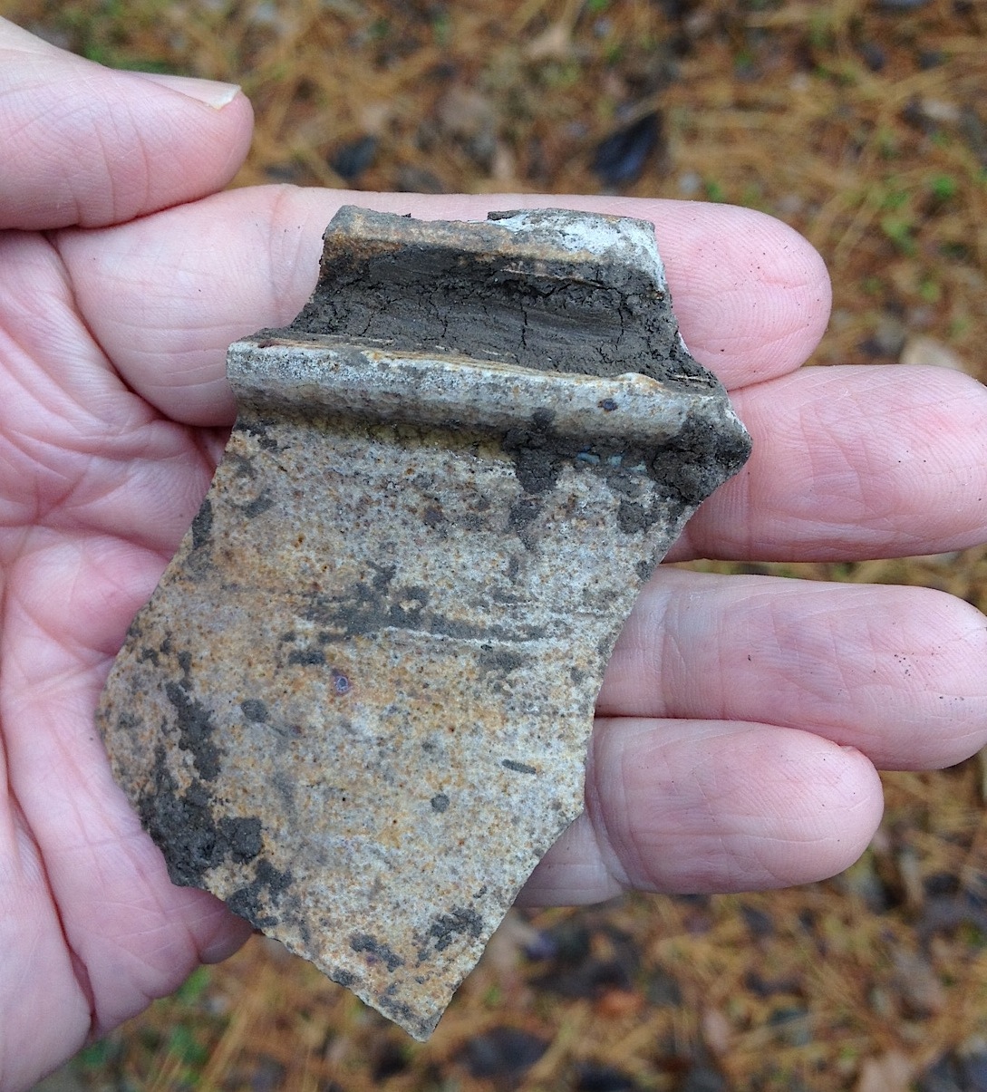
This was a bit of a surprise, as the area around the fort (called the glacis) was meant to be kept clear for defensive purposes. However, Fort de Chartres was located in a rather sleepy place, militarily speaking. During the last years of this facility (which probably stood until the mid-1750s) most of the soldiers affiliated with the fort were actually stationed elsewhere. It would appear that those remaining in the fort, or perhaps some of the residents of the adjacent village, eventually set up a garden just outside of the bastion. A fragment of an unusual French stoneware pot or jug was found in one of the fence line trenches, and may have been used in the garden for watering or for other purposes.
What intrigues me about this find is that it is so unofficial. The little fence wasn’t part of the grand plan of the fort. Instead it represents both the everyday reality of needing to grow your own food, as well as the slow, quiet tide of village life that eventually overtook the site of the 1732 fort.

Saturday, October 27, 2012

Back to Fort de Chartres part I


One of several storms approaching.

I have been lost in writing a sequel to the “At Home in the Illinois Country” book, this one focusing on seventeenth and eighteenth century Native American villages and French forts in the Illinois Country. For this reason, I’m afraid I haven’t spent much time updating the blog this summer. However, I finally got a break from the lab and the computer – as we spent another 2 weeks at the site of the 1732 Fort de Chartres.

This year, we opened a larger area, in hopes of exposing the plan of the northeast bastion of the fort. The project did just that – and we now have a good idea of how the fort was built, repaired, and what kind of activities occurred inside. The next few posts will focus on what we found. But first, here are a few snapshots of the 2012 work, and our dedicated volunteer crew. Thanks to everyone who leant a hand in the rain and the cold wind.

More to come….
Site view.
Jane profiling a pit feature abandoned before 1760.
Ron excavating one of the wall trenches that supported the bastion wall.
Robert mapping the wall trenches.
Margaret removing the redeposited remains of a fireplace.
A damp and dedicated crew, October 2012.

Crew pictures courtesy of Corinne Carlson...


Saturday, September 15, 2012

Ethnicity in Antebellum St. Louis

An Irish neighborhood in St. Louis, 1858.
        In St. Louis, the neighborhoods straddling Biddle Street between 6th and 12th Streets during the mid 19th  century were generally remembered as densely populated residential districts inhabited primary by working class Irish immigrants. During the 1850s, 60s, and 70s, particular areas of the neighborhood were known by informal names such as  “Kerry Patch” (referring to County Kerry in Ireland), “Castle Thunder” (a particularly scary tenement building), and “Clabber Alley” (referring to sour milk). Census information, however, indicates that these neighborhoods were also well populated by German immigrants.

I just finished a study of thousands of artifacts, dating circa 1840-1865, that were excavated in this neighborhood. One of the findings of the study is that this very ethnic part of the city doesn’t really look much different from other neighborhoods of the same period, at least through the lens of archaeological artifacts. Instead, what we see by the mid 19th century is essentially a mass-produced, mass marketed material universe, not unlike the one we know today.
Two mid-19th century pipes from St. Louis: A British pipe with thistle motif,
 and a personalized German porcelain pipe.
            There were only a few objects that, by themselves, speak of the unique heritage of the neighborhood. These include traditional redware food storage and cooking pots, German porcelain smoking pipes, and British-made smoking pipes decorated with traditional Irish and Scottish symbols. Even at a folk-object level, traditional symbolism was complex: an unusual folk pipe that might be attributable to German immigrant pipe-maker Henry Nolle, is decorated with a portrait of Napoleon.
A smoking pipe possibly made by St. Louis pipe-maker Henry Nolle, around 1845. 
        The lesson here is that our cultural identity has been largely untethered from the things that we buy in stores for a very long time.


Wednesday, July 25, 2012

The Ancestor of Pepsi in Antebellum St. Louis

As I've been working on a report on a massive collection of artifacts from a Irish neighborhood in St. Louis, dating to the 1840s and 1850s, I thought I'd post a few more examples of relevant artifact types. Then I will return to the frontier and colonial periods of the region.
The first soda water bottle made for a St Louis merchant.
Made between 1845 and 1847.
Commonly recovered from archaeological mid-nineteenth century features in St. Louis are early soda water bottles. Soda water was first bottled in St. Louis in 1845, by druggists Rudolph and John Adams. A newspaper advertisement placed by the druggists in the spring of that year actually explained to local consumers that their product was “bottled by machinery in such a manner as to retain the fixed air perfectly, which renders it a beverage quite as delightful as being drawn from the fountain itself ”. 
Being the earliest form of the bottled, flavored soda pop that is so ubiquitous today, these products were also marketed for their health effects during the mid-nineteenth century (probably most often as relief for stomach complaints). 

Saturday, June 30, 2012

Importers' Marks from St. Louis


Keeping on the St. Louis theme for a bit…

I’m working on a study of pre-Civil War artifacts recovered during the 1990s from several downtown neighborhoods. On this post, I thought I’d show some rather rare “importers’ marks” found on ironstone (and whiteware) plates dating to the 1840s and 1850s.

Large scale American wholesalers of British “Queenswares” (the generic term for refined British earthenwares from pottery centers such as Staffordshire) often created direct relationships with the manufacturers of the table and teawares sold in their stores. In some cases, the names of these American merchants were printed directly on the pottery (alongside the makers’ names). A number of St Louis wholesalers (dating as early as the late 1820s) had such relationships with British potters, and some of their names are marked on pottery excavated in St Louis and the surrounding communities.

Here’s a sampling of St Louis makers’ marks. These are pretty rare – they appear on fewer than 5% of the marked specimens that we recover archaeologically. Besides providing a glimpse into the nature of the international trade in mass-produced goods during the mid 19th century, these artifacts also serve to illustrate the very important role St Louis played in shaping the material landscape of the Midwest before the Civil War. A very large percentage of the pre –1860 material culture that is excavated across Missouri, Illinois, Wisconsin, and Minnesota (as well as further up the Missouri River) began its journey in a warehouse in downtown St Louis.

A colleague of mine is preparing an overview of St Louis importers, so stay tuned….


Saturday, June 16, 2012

A Forgotten Eighteenth Century House in St Louis?


Speaking of archaeological features in St Louis (see my last post), here’s a remarkable structure that’s about to become archaeology. The remains of this stone house are located between Lafayette Square and Choteau Avenue. These photos were taken in the mid 1990s, and I’m sorry to report that the building has since lost one of its exterior walls.  It’s now just a picturesque ruin, but I’m wondering if anyone recorded the house when in was in better shape. 
The house as it looked in the mid-1990s.

The sign posted on the front of the house during the 1990s claimed it was constructed “circa 1790” by a “French fur trader” called  Joseph Mottard.

Does anyone out there know anything more about this site? I hope someone recorded it back in the day…. 

Ruins of the house in 2010.   


Thursday, June 14, 2012

Aspects of Urban Archaeology

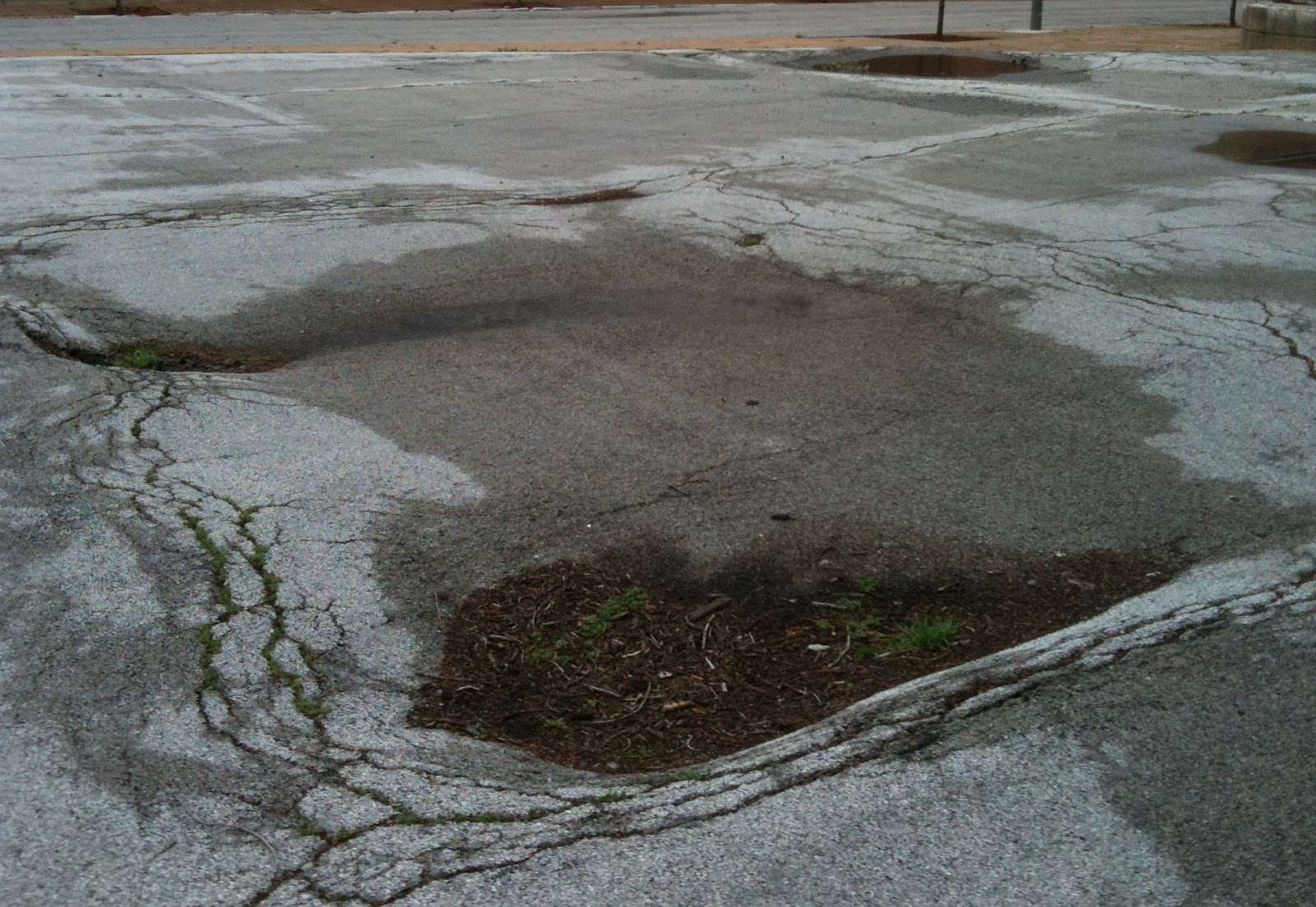
I took this photo in an 1840s-1850s residential neighborhood in St. Louis. A house once stood here, torn down long ago. More recently, the lot was paved over with asphalt. The fill of the cellar associated with house gradually compacted and slumped, causing depressions to form in the asphalt above. Now, when it rains, pre-Civil War archaeological features are plainly visible. Imagine what may lie beneath.