
This post will begin to
describe the results of our 2012 archaeological testing at the site of the 1732 Fort
de Chartres, in Randolph County, Illinois. The fort was built by the French to
provide a military and governmental center for the Illinois Country colony. It
was the third of four versions of the fortification.

Like most French colonial
forts of the period, this version of Fort de Chartres was of the “Vauban” plan,
consisting of central square area flanked by four diamond-shaped bastions. The
central area housed most of the buildings associated with the fort (as well as
the parade grounds), while the bastions provided defensive views of the walls
of the fort and also housed specialized buildings. The walls of the fort were
constructed of wooden poles set into deep trenches. The outlines of those
trenches are still visible in the subsoil today, and allow us to accurately map
the size and shape of the structure.

Our work at the site exposed
the northeast bastion of the fort.
The base map above shows the features that we encountered there. The tan
color represents areas of subsoil exposed by our test units and trenches. The
black lines represent wall trench features. The gray shapes are pit features,
and the small red shapes are posts.
In appreciation of the hard
work provided by the good folks at the Fort de Chartres Heritage Garden (who
demonstrated eighteenth century colonial culinary traditions at the Winter Rendezvous), I will begin with something unusual that we found outside of the limits of the fort.
As you can see in the second
plan map (below), there are a series of narrow, perpendicular trenches that are
anchored to the very tip of the bastion of the fort. These were very shallow
features that could only have supported short, narrow posts - such as those
that one would expect on low fencing. Such a fence would not have been
sufficient to contain large animals, and instead, I am of the opinion that
these trenches reflect a produce garden that was situated just outside
the northeast bastion of the fort.

 |
| Trenches outside of the fort, as first exposed in excavation block. |
This was a bit of a
surprise, as the area around the fort (called the glacis) was meant to be kept clear for defensive purposes.
However, Fort de Chartres was located in a rather sleepy place, militarily
speaking. During the last years of this facility (which probably stood until
the mid-1750s) most of the soldiers affiliated with the fort were actually
stationed elsewhere. It would appear that those remaining in the fort, or
perhaps some of the residents of the adjacent village, eventually set up a
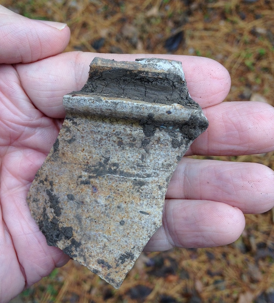
garden just outside of the bastion. A fragment of an unusual French stoneware
pot or jug was found in one of the fence line trenches, and may have been used
in the garden for watering or for other purposes.
What intrigues me about this
find is that it is so unofficial.
The little fence wasn’t part of the grand plan of the fort. Instead it
represents both the everyday reality of needing to grow your own food, as well
as the slow, quiet tide of village life that eventually overtook the site of the
1732 fort.
Great drawings. Beautiful site.
ReplyDelete